Community Notice
Issued on Monday, June 9th, 2025 at 6:00 pm
LLRIB-EOC Emergency Update
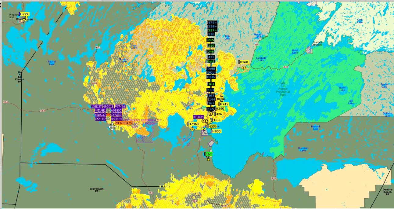
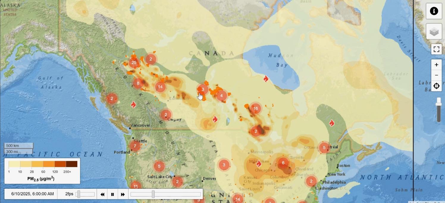
Due to ongoing wildfire threats in our region, evacuation orders remain in place for Hall Lake, Sucker River, Brabant, La Ronge, and Stanley Mission (P1s and P2s). Emergency response efforts continue with enhanced provincial and national coordination.
· The incident perimeter remains stable, with low activity and manageable hotspots in Hall Lake and surrounding zones.
· Beneficial rainfall from recent storms has improved conditions across many sectors.
· Near Napatak, the fire is about 4 km south of the community and remains in the bush. It is not visible from the highway.
· The Sucker River fire, near the Stanley Mission Junction, remains a priority as it has zero containment. Crews are focusing efforts to stop northward spread.
· Ongoing monitoring and structure protection is in place for Big Stone, the industrial park, Little Lake, and community perimeters.
· 13 helicopters, 2 tanker groups, and 10–12 water trucks are on site.
· 45 Type 1 wildfire crews (mostly from Saskatchewan), 75 Type 2, and 48+ Type 3 crews are active—this includes teams from Onion Lake, Cote, Beardy’s, and others.
· 8 volunteer fire departments are assisting, with 8 bulldozers working on fire guards and dozer lines.
· Teams are actively working the Ditch Fire, Pisew Fire, and Sucker River Fire, with operational briefings held daily.
• Recent Rainfall: The region received 2–10 mm of rain over the weekend, which helped cool hotspots and slow fire growth.
• Projected Rainfall:
◦ Monday night into Tuesday: Additional 2–5 mm expected across most fire zones.
◦ Wednesday and Thursday: Spotty showers and 5–10 mm forecasted, which could further assist suppression.
· Temperature: Highs of 20°C expected today and tomorrow.
· Humidity: 30–35%, keeping forest fuels dry.
· Winds: Currently from the northwest at 15–25 km/h with gusts reaching up to 45 km/h, which may cause fire spread and increased smoke drift.
· Thunderstorms: Scattered thundershowers are forecast tonight into Tuesday, bringing 2–5 mm of rainfall. However, lightning strikes may increase new ignition risks.
· Smoke Conditions:
o Thick smoke is still impacting visibility and air quality in many areas, due to both local fires and incoming smoke from Alberta and British Columbia.
o Air operations remain restricted during periods of dense smoke and poor visibility.
· Mapping data shows 181,765 hectares affected. Drone flights and full re-scans are ongoing.
· Facility re-opening: SHA teams arrive tomorrow to assess the emergency department, power systems, and sanitation in evacuated communities.
o Lab services to be tested by Wednesday.
·  Southbound travel is permitted.
·  Access northbound is limited to emergency and essential personnel on the clearance list only.
This wildfire emergency is still ongoing. Please:
· Follow evacuation orders and emergency advisories.
· Reduce travel unless authorized.
· Register for updates through official channels.
We acknowledge and deeply thank all first responders, volunteers, and community members working day and night to protect our people and homes.
— Chief Tammy Cook-Searson & the LLRIB Emergency Operations Centre